Prepare your season
A route planner built for trail running
By Simon Busch · · 4 min read
Short answer
Kliva has its own routing engine, built for trail running and not adapted from cycling or road maps. It draws loops that favour trails, keeps to your distance and your climbing range, counts the D+ close to what your watch counts, and also builds a hill session: it finds climbs near you and plans the repeats for your D+. It is available in Belgium, Switzerland and France for now.
Why does trail need its own routing engine?
Most route calculators were made for roads and bikes. They look for the shortest or the smoothest way from A to B, and they treat a path through a forest as a detour. A trail runner wants the opposite: the trail, the climb, the view, and a loop that comes back to the car.
Kliva's routing engine was built for trail from the start. It is not a cycling or road engine with a trail filter on top. It reads trails, forest tracks and paths as the places to run, and it plans with the climbing you ask for, in metres.
What does it do differently?
- Trails first: it prefers paths and forest tracks over tarmac.
- Climbing in metres: you give a range of D+, not an "easy" or "hard" setting.
- D+ close to your watch: it counts the climb the way a watch does, so the number on the route is close to the number on your wrist.
- Surface by section: the share of road, forest track and path, section by section.
- Hiking grade by section: a T1 to T6 grade on each stretch, so you see where it gets technical.
It also drops the loops that walk a street up and back down its sidewalk, and the dead ends that send you back the way you came. When you ask to avoid roads, it keeps to it.
What about a hill session on a climb near me?
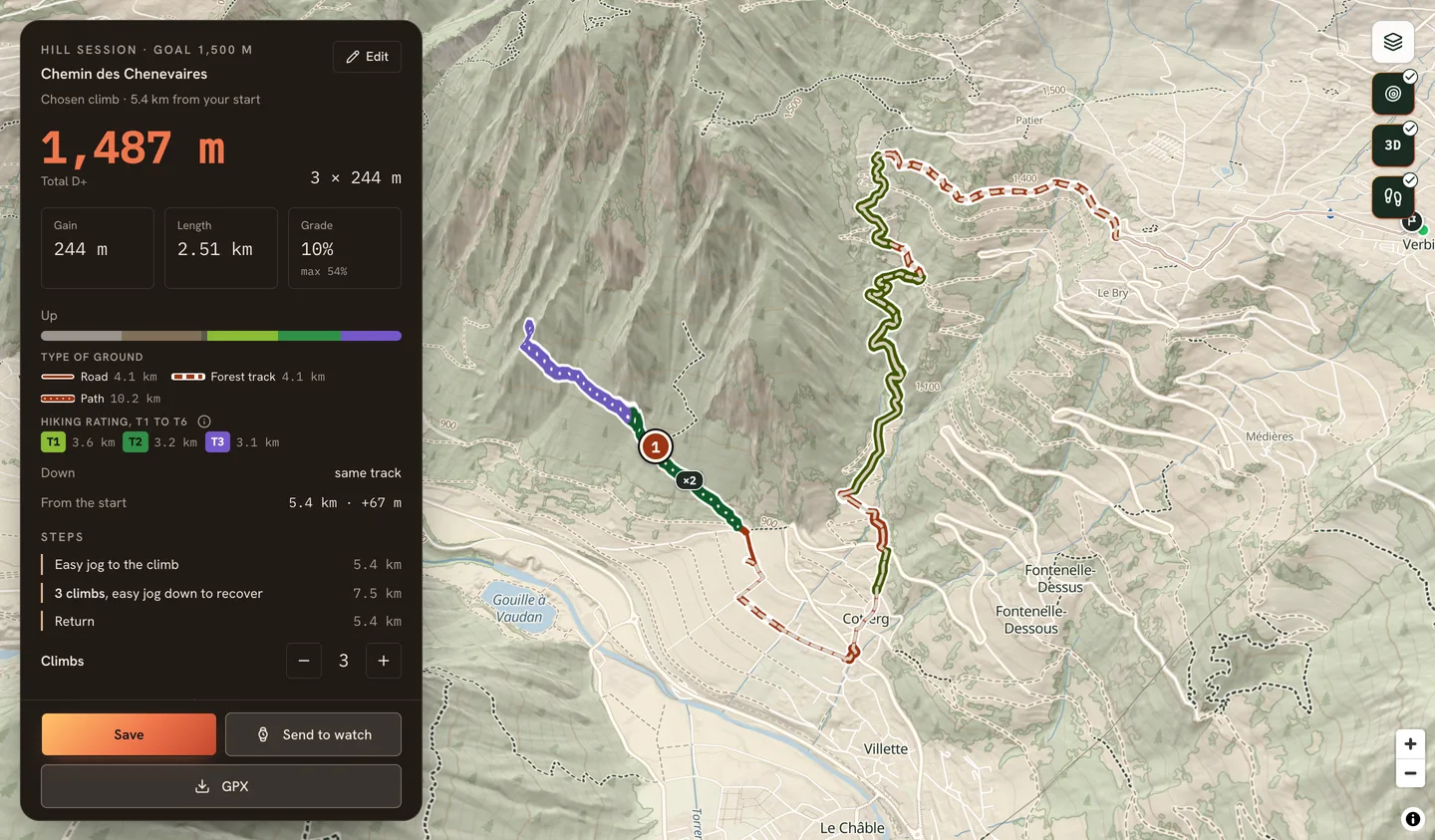
This is one of the most useful things the planner does for a trail runner. Hill repeats are the session closest to a mountain race: you bank D+ in training, you build your climbing legs, and you learn to handle a steep slope by repeating it. The hard part is finding it: which climb near home, how long it is, how steep, how many times to climb it to reach your D+, and how to get there and back without running on the road.
Pick the Hill session mode, give the total D+ you want and a radius around your start (1, 3 or 5 km). Kliva looks for the real climbs around you and lists them with their name when they have one, their D+, length, average grade and maximum grade. You can sort them by steepness, length or distance from your start, then pick one.
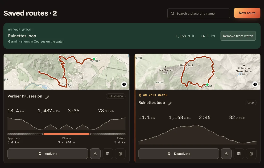
On the climb you picked, it plans the number of repeats to reach the D+ you asked for, and you can change that by one with + and −. The route is drawn in three parts: an easy jog to the foot of the climb, the repeats with an easy jog down to recover, then the way back. The way there and back favours trails, and you see their distance before you go. Then you send it to your watch like any other route.
How do I get three loops from my door?
Open the route generator and pick a start: your location, a home point, an address, or a spot on the map. Give a distance or a time, and a climbing range in metres. Kliva draws three proposals.
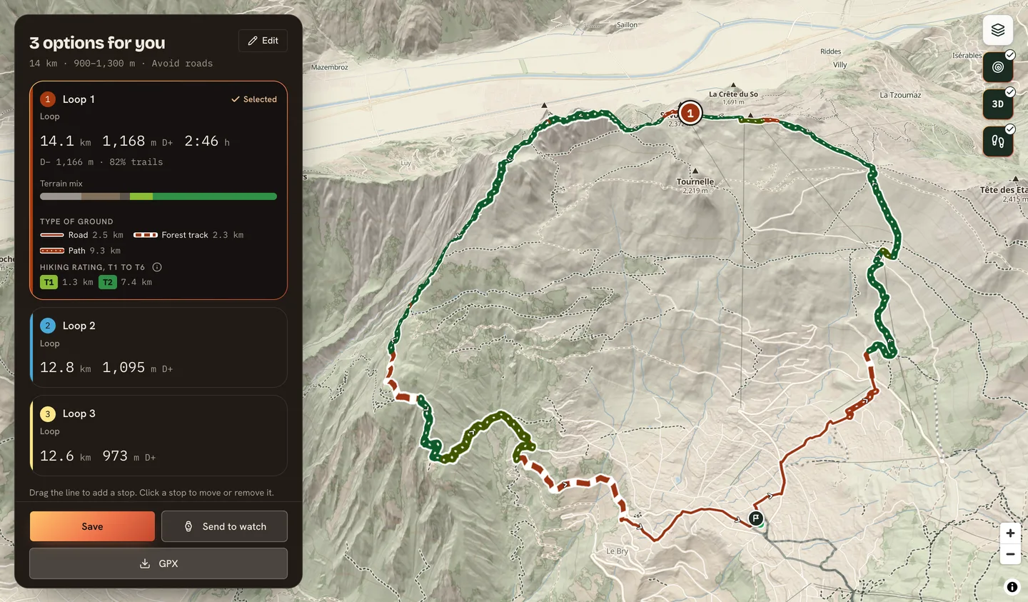
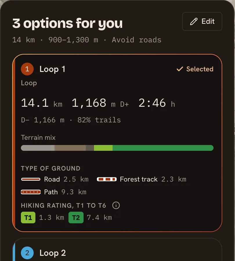
Each proposal shows its distance, its D+, and how the surface splits between road, forest track and path. Pick the one that suits your day.
What do surface and trail grade tell me?
Select a proposal and its card adds up the surface and the hiking grades, while the map colours each stretch. Grades run from T1, an easy trail, to T6, which is for mountaineers. A loop that looks short on paper can hide a T4 ridge, and now you see it before you leave.
How close is the D+ to my watch?
Elevation is where route tools disagree most, so we measured it. On our test routes, the D+ Kliva draws came to 94 to 100 % of what a watch counted on the same ground. We say "close to your watch" and not "exact", because a watch has its own way of smoothing the climb.
Can I change the route, or go from A to B?
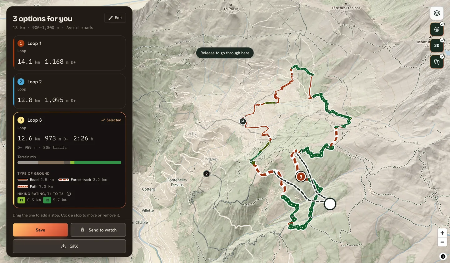
Yes. Drag the line to pass where you want and Kliva shows a dashed preview of the new route before you keep it. You can also go from A to B with stops on the way, or come back to the start from wherever you end.
How does it reach my watch?
Save the routes you like, then export a GPX file. On a Garmin, you can send a route straight to the watch with its turn prompts. Saved routes show what is already on your watch.
Where does it work?
The route generator is available in Belgium, Switzerland and France for now. Outside these countries the data is not ready yet. We add countries as the data is ready.
A trail can be missing from the map, closed for the season or cross private land: always follow the signs on the ground.